HISTORIX Vintage 1895 Houston City Map - and 50 similar items


Free Shipping
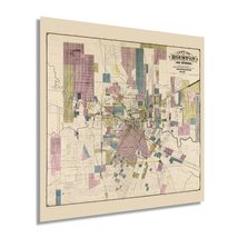
HISTORIX Vintage 1895 Houston City Map - 16x16 Inch Houston Texas Vintage Map -
$37.99 - $49.99
View full item details »

Shipping options
Seller handling time is 1 business day Details
FREE via to United States
Return policy
Full refund available for DOAs
Details
Purchase protection
Payment options
PayPal accepted
PayPal Credit accepted
Venmo accepted
PayPal, MasterCard, Visa, Discover, and American Express accepted
Maestro accepted
Amazon Pay accepted
Nuvei accepted
View full item details »
Shipping options
Seller handling time is 1 business day Details
FREE via to United States
Return policy
Full refund available for DOAs
Details
Purchase protection
Payment options
PayPal accepted
PayPal Credit accepted
Venmo accepted
PayPal, MasterCard, Visa, Discover, and American Express accepted
Maestro accepted
Amazon Pay accepted
Nuvei accepted
Item traits
| Category: | |
|---|---|
| Quantity Available: |
16 in stock |
| Condition: |
New |
| UPC: |
693634010219 |
| Item Name: |
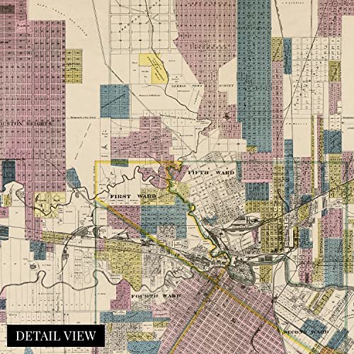
1895 City of Houston and environs |
| Item Type Keyword: |
prints |
| Product Site Launch Date: |
2021-10-14T13:49:20.172Z |
| Unspsc Code: |
60121013 |
| sizes: |
Listing details
| Seller policies: | |
|---|---|
| Shipping discount: |
Seller pays shipping for this item. |
| Posted for sale: |
May 1 |
| Item number: |
1743605939 |
Item description
This unique depiction of Texas' largest and the fourth largest city in the United States shows it in a period of significant growth and transformation. As the city’s economy boomed due to the vast reserves of oil being pumped in East Texas, its culture flourished as the nation raced toward the turn of the century. Houston was first settled in 1837 at the junction of Buffalo and White Oak bayous and had grown tremendously by the end of the nineteenth century. The population had reached nearly sixty-thousand by 1900, and numerous economic drivers spurred the population from importing and exporting to manufacturing and oil field administration.
Access had been increased with the completion of numerous railroads making Houston the first major hub in the American south in the years preceding the Civil War. In 1891 electric streetcars replaced mule-driven wagons as the primary source of transportation throughout the city’s downtown and burgeoning suburbs. This land use map shows the city becoming a modern icon of America synonymous with Texas' cultural identity.
This depiction's unique aesthetic and signature style immediately transport the viewer back in time, creating an indelible bond between the past and present. Texas was readmitted to the Union in 1870 following the conclusion of the Civil War and had experienced no battles in the city during the conflict. This is an authentic piece of American and Texan cartographical history, and was produced by noted Houston-based surveyors Whitty and Stott and published by EB Noll.
Our museum quality giclee print comes printed with archival ink on premium heavyweight matte paper. Shipped in a sturdy cardboard tube your print will arrive ready to be framed. This eye-catching vintage map reproduction print makes the perfect gift for anyone that loves history and imagery.
|
Why are we showing these items?
Booth
Historic Prints |

|

-
Refine your browsing experience
We can show you more items that are exactly like the original item, or we can show you items that are similar in spirit. By default we show you a mix.
This item has been added to your cart
 HISTORIX Vintage 1895 Houston City Map - 16x16 Inch Houston Texas Vintage Map - added to cart.
16 available in stock
HISTORIX Vintage 1895 Houston City Map - 16x16 Inch Houston Texas Vintage Map - added to cart.
16 available in stock
View Cart or continue shopping.
 Please wait while we finish adding this item to your cart.
Get an item reminder
We'll email you a link to your item now and follow up with a single reminder (if you'd like one). That's it! No spam, no hassle.
Already have an account?
Log in and add this item to your wish list.