Rendered at 03:28:18 05/06/25


Free Shipping
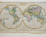
AUTHENTIC 1779 MAP OF THE WORLD WITH THE LATEST DISCOVERIES - REV. JOHN BLAIR

Shipping options
Seller handling time is 2 business days Details
FREE in United States
Offer policy
OBO - Seller accepts offers on this item.
Details
Return policy
Partial refund available within 30 days
Purchase protection
Payment options
PayPal accepted
PayPal Credit accepted
Venmo accepted
PayPal, MasterCard, Visa, Discover, and American Express accepted
Maestro accepted
Amazon Pay accepted
Nuvei accepted
Item traits
| Category: | |
|---|---|
| Quantity Available: |
Only one in stock, order soon |
| Condition: |
Unspecified by seller, may be new. |
| Type: |
World Atlas |
| Year: |
1779 |
| Seller Notes: |
“Authentic Map in very good condition” |
| Product Type: |
Map |
| Country Region: |
World |
| Topic: |
Maps |
| Publication Year: |
1779 |
| Map View: |
World |
| Original or Reproduction: |
Original |
| Region: |
World |
| Style: |
Antique |
Listing details
| Seller policies: | |
|---|---|
| Shipping discount: |
Seller pays shipping for this item. |
| Posted for sale: |
More than a week ago |
| Item number: |
1293356752 |
Item description
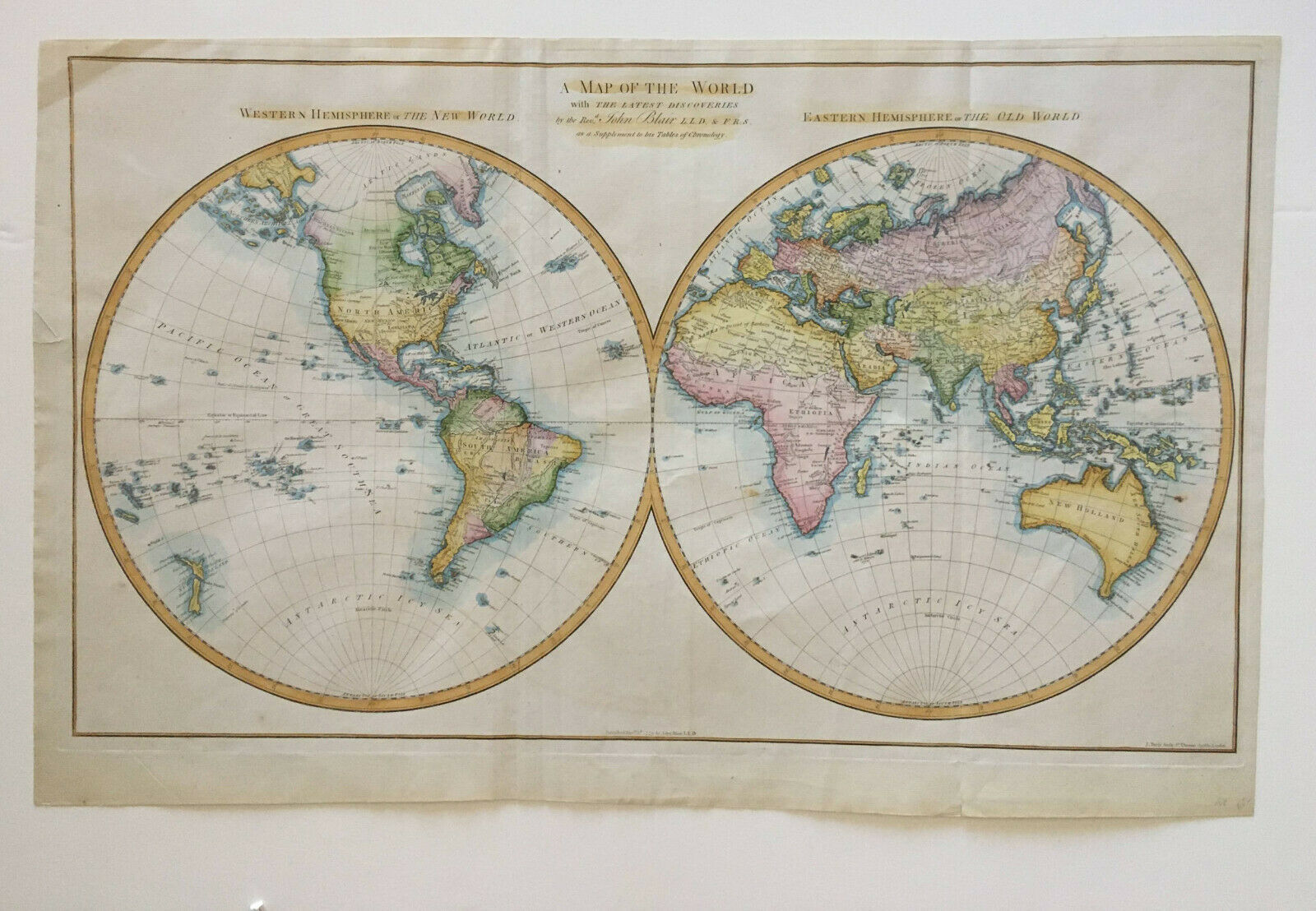
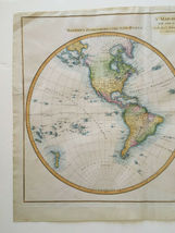
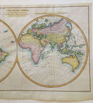
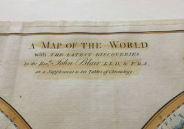
AUTHENTIC MAP OF THE WORLD WITH THE LATEST DISCOVERIES
BY THE REV. JOHN BLAIR LLD AND FRS, AS A SUPPLEMENT TO HIS TABLES OF CHRONOLOGY, PUBLISHED 1779
Very nice detail.
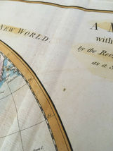
Title:
A Map of the World with the latest discoveries by the Revd. John Blair
Date: C1779
Mapmaker: John Blair - (1725 - 1783)
Engraver: J.Bayly
Sheet Size: 465mm x 740mm
Condition: In good condition with center fold as issued. Little age toning. Small tear. Two sheets joint (appears to be out of Atlas). See pictures as they are part of the description.
Technique: Copper engraving hand colored
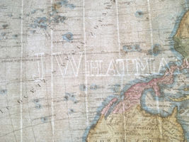
On laid paper with watermark J WHATMAN +
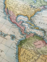
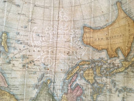
Interesting and scarce world map with unusual use of place names on the Australian east coast and New Zealand coast. This map published only six years after James Cook's seminal chart of the east coast of Australia (1773), the addition of place names other than those given by Cook is certainly unusually, given that there was no other source until the arrival of the First Fleet in 1788.
It is a striking double hemisphere map of the World, at the time of
Cook's Third Voyage. Hawaii is not shown. Interesting NW Coast of
America, including a NW Passage and Russian place names. The Mythical
River of the West is still shown. Curious New Zealand and Australia
(with Van Diemen's Land attached to the mainland). Interesting detail in
North America and Africa. Australian Coastline still largely unknown.
John Blair was a founding father of the science of Chronology, he received a clerical education in Edinburgh and moved to London where he received his law doctorate (Legum Doctor, LLD), became a fellow of the Royal Society (FRS), and was employed as the tutor to King George III's brother. He accumulated honors and rewarding charges (such as the vicarage of Saint Bride in London, and the rectory of St John the Evangelist in Westminster).
Added to your wish list!
- AUTHENTIC 1779 MAP OF THE WORLD WITH THE LATEST DISCOVERIES - REV. JOHN BLAIR
- 1 in stock
- Price negotiable
- Handling time 2 days.
- Returns/refunds accepted
Get an item reminder
We'll email you a link to your item now and follow up with a single reminder (if you'd like one). That's it! No spam, no hassle.
Already have an account?
Log in and add this item to your wish list.