HISTORIX Vintage 1883 Duluth Minnesota Map Poster - 12x24 Inch Old View of Dulut
Shipping options
Seller handling time is 1 business day Details
This reflects the seller's handling time and may not include time spent in transit.
If you have questions about shipping, please contact the seller.
FREE via to United States
Return policy
Full refund available for DOAs
Details
- We guarantee our products and offer full refunds or exchange for defective items or items not as-described.
- Buyer must contact us within 30 days after receipt of shipment.
- The item must be received in the same condition as shipped.
- Items must be returned with all original packaging and accessories.
- Items must not be abused, modified or damaged by accident.
- A 20% restocking fee will be charged for returns
- Buyer is responsible for all return shipping and handling fees.
- Restocking and return shipping fees do not apply when item is returned as defective or because incorrect product was delivered.
Payment options
PayPal accepted
PayPal Credit accepted
Venmo accepted
PayPal, MasterCard, Visa, Discover, and American Express accepted
Maestro accepted
Amazon Pay accepted
Nuvei accepted
Item traits
| Category: |
Kitchen Scales
|
| Quantity Available: |
16 in stock
|
| Condition: |
New
|
| ASIN: |
B0BWVKFSMD
|
| Color: |
Natural
|
| Bullet Point: |
View details
VINTAGE MAP REPRODUCTION: You’ll love this high quality historic reproduction of 1883 Duluth City Minnesota Map Poster. Our museum quality prints are archival grade, which means it will look great and last without fading for over 100 years. Our pr...
|
| Product Description: |
View details
The region first experienced European exploration and settlement beginning in the seventeenth century, with fur trappers looking to supply Europe's demand for beaver fur. These trappers traded with indigenous populations and established small c...
|
| Brand: |
HISTORIX
|
| Supplier Declared Dg Hz Regulation: |
not_applicable
|
| Item Name: |
View details
HISTORIX Vintage 1883 Duluth Minnesota Map Poster - Old View of Duluth Minnesota Wall Art Print - Restored History Map of Minnesota Poster
|
| Item Type Keyword: |
prints
|
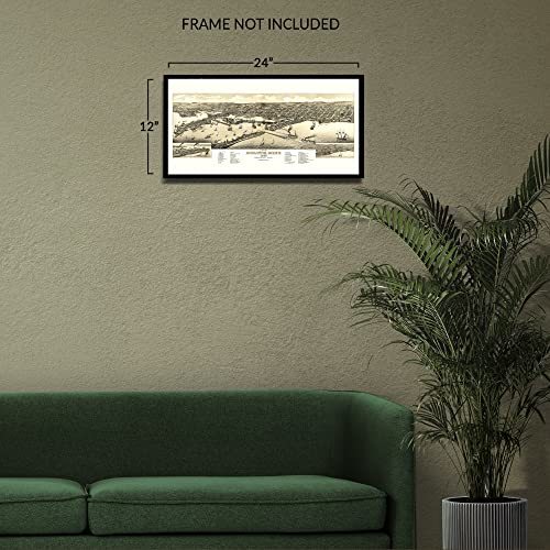
| sizes: |
View details
12x24 Inch (8 in stock)
24L" x 36W" (8 in stock)
|
Listing details
|
Seller policies:
|
View seller policies
|
|
Shipping discount:
|
Seller pays shipping for this item.
|
|
Posted for sale:
|
May 1
|
|
Item number:
|
1743618837
|
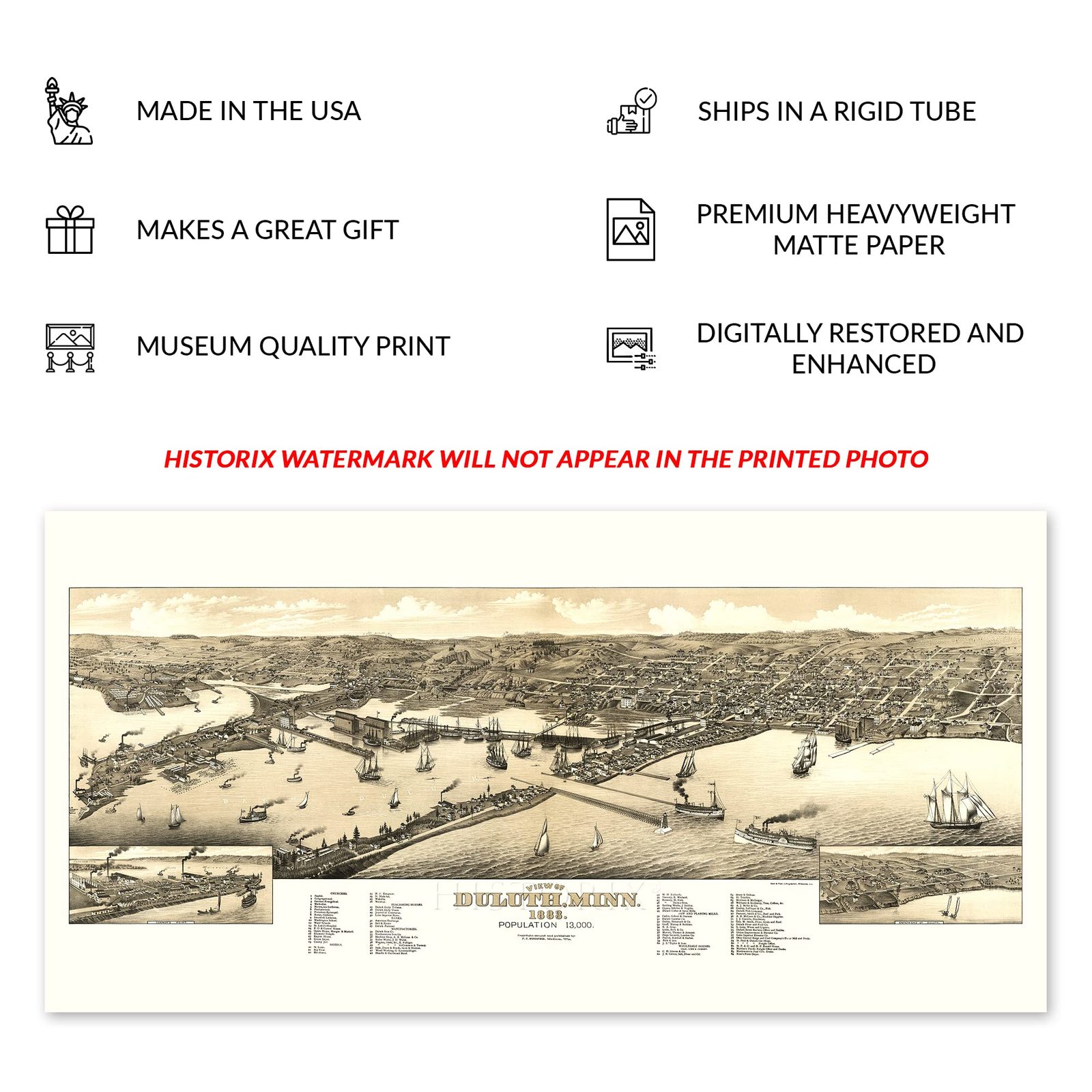
The region first experienced European exploration and settlement beginning in the seventeenth century, with fur trappers looking to supply Europe's demand for beaver fur. These trappers traded with indigenous populations and established small camps that would grow into towns and cities over the course of the eighteenth and nineteenth centuries. Duluth became a critically important city known for its cargo shipping abilities due to its location on Lake Superior. The first official business was established in Duluth in 1808 with the American Fur Company, which German-born immigrant George Astor founded. The region attracted thousands of immigrants looking for economic opportunities in copper and iron ore mining.
Produced and published by Henry Wellge, who was among one of the most prolific mapmakers of the nineteenth and twentieth centuries and is responsible for creating half of all bird's eye perspectives in the Library of Congress, along with five other publishers. Wellge's works bear a distinctive style and classic aesthetic that was designed to attract residents and merchants alike by featuring local businesses and civic features. Panoramic maps were created as marketing materials to attract residents. By the 1880s, Duluth was growing rapidly as advances in transportation allowed access to the North and West following the conclusion of the American Civil War.
Bird's eye perspectives were not limited by the need to be used for navigation and immediately transport the viewer back in time, creating an indelible bond between the past and present. They are distinctive pieces of American cartographical history and culture.
Additional Details
------------------------------
Bullet point: VINTAGE MAP REPRODUCTION: You?ll love this high quality historic reproduction of 1883 Duluth City Minnesota Map Poster. Our museum quality prints are archival grade, which means it will look great and last without fading for over 100 years. Our print to order maps are made in the USA and each map is inspected for quality. This beautiful artwork is a perfect addition to your themed decor. Vintage maps look great in the home, study or office. They make a perfect gift as well.
Product description:
The region first experienced European exploration and settlement beginning in the seventeenth century, with fur trappers looking to supply Europe's demand for beaver fur. These trappers traded with indigenous populations and established small camps that would grow into towns and cities over the course of the eighteenth and nineteenth centuries. Duluth became a critically important city known for its cargo shipping abilities due to its location on Lake Superior. The first official business was established in Duluth in 1808 with the American Fur Company, which German-born immigrant George Astor founded. The region attracted thousands of immigrants looking for economic opportunities in copper and iron ore mining.
Produced and published by Henry Wellge, who was among one of the most prolific mapmakers of the nineteenth and twentieth centuries and is responsible for creating half of all bird's eye perspectives in the Library of Congress, along with five other publishers. Wellge's works bear a distinctive style and classic aesthetic that was designed to attract residents and merchants alike by featuring local businesses and civic features. Panoramic maps were created as marketing materials to attract residents. By the 1880s, Duluth was growing rapidly as advances in transportation allowed access to the North and West following the conclusion of the American Civil War.
Bird's eye perspectives were not limited by the need to be used for navigation and immediately transport the viewer back in time, creating an indelible bond between the past and present. They are distinctive pieces of American cartographical history and culture.