HISTORIX Vintage 1889 Paducah Kentucky Map and 50 similar items


Free Shipping
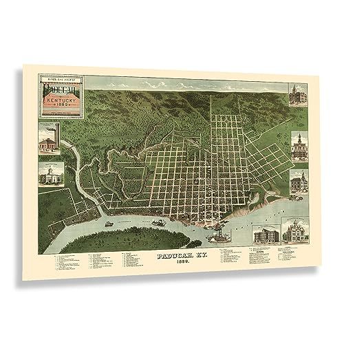
HISTORIX Vintage 1889 Paducah Kentucky Map Poster - 24x36 Inch Bird's Eye View o
$59.99
View full item details »

Shipping options
Seller handling time is 1 business day Details
FREE via to United States
Return policy
Full refund available for DOAs
Details
Purchase protection
Payment options
PayPal accepted
PayPal Credit accepted
Venmo accepted
PayPal, MasterCard, Visa, Discover, and American Express accepted
Maestro accepted
Amazon Pay accepted
Nuvei accepted
View full item details »
Shipping options
Seller handling time is 1 business day Details
FREE via to United States
Return policy
Full refund available for DOAs
Details
Purchase protection
Payment options
PayPal accepted
PayPal Credit accepted
Venmo accepted
PayPal, MasterCard, Visa, Discover, and American Express accepted
Maestro accepted
Amazon Pay accepted
Nuvei accepted
Item traits
| Category: | |
|---|---|
| Quantity Available: |
8 in stock |
| Condition: |
New |
| UPC: |
705514888174 |
| MPN: |
ENMAP06462436 |
| EAN: |
0705514888174 |
| Color: |
Natural |
| binding: |
unbound |
| format: |
unbound |
| language: |
english |
| manufacturer: |
HISTORIX |
| Externally Assigned Product Identifier: |
0705514888174 |
| Bullet Point: | |
| Publication Date: |
1889T |
| Product Description: | |
| Brand: |
HISTORIX |
| Unspsc Code: |
55101500 |
| Paper Finish: |
matte |
| Map Scale: |
1000 |
| Item Name: | |
| Item Type Keyword: |
prints |
| Product Site Launch Date: |
2023-08-04T02:27:43.438Z |
| Part Number: |
ENMAP06462436 |
Listing details
| Seller policies: | |
|---|---|
| Shipping discount: |
Seller pays shipping for this item. |
| Posted for sale: |
April 5 |
| Item number: |
1736369092 |
Item description
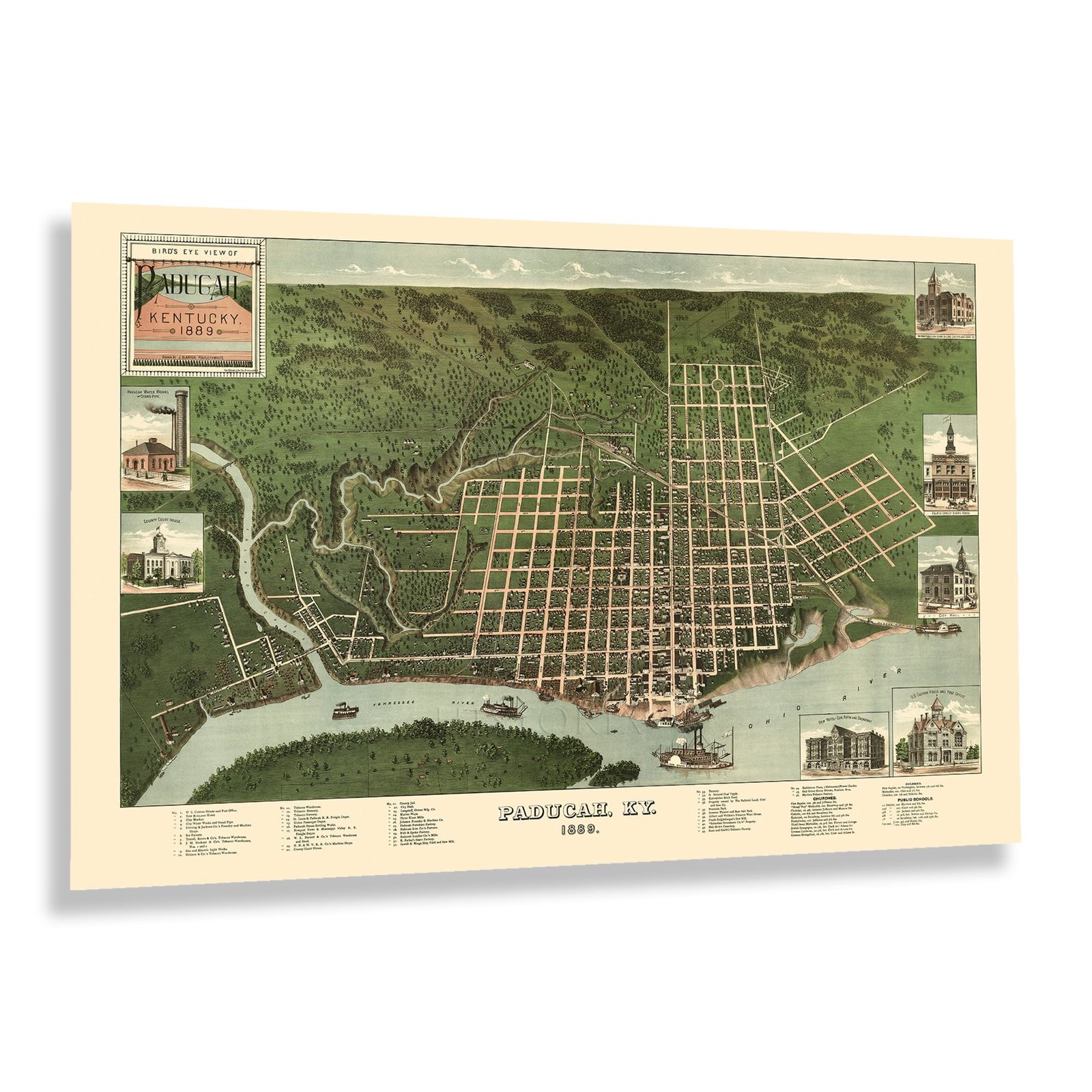
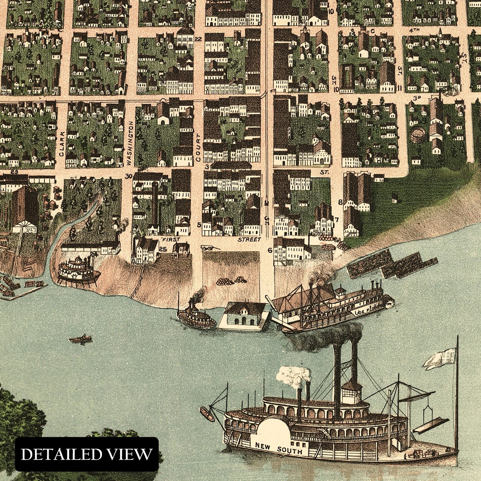
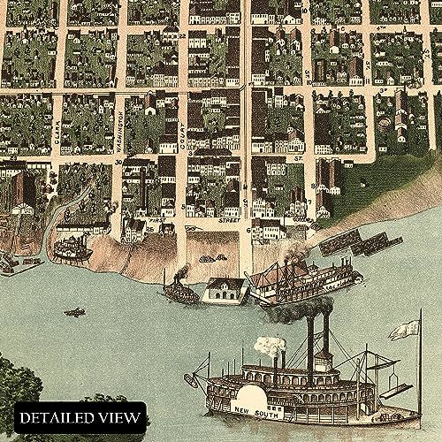
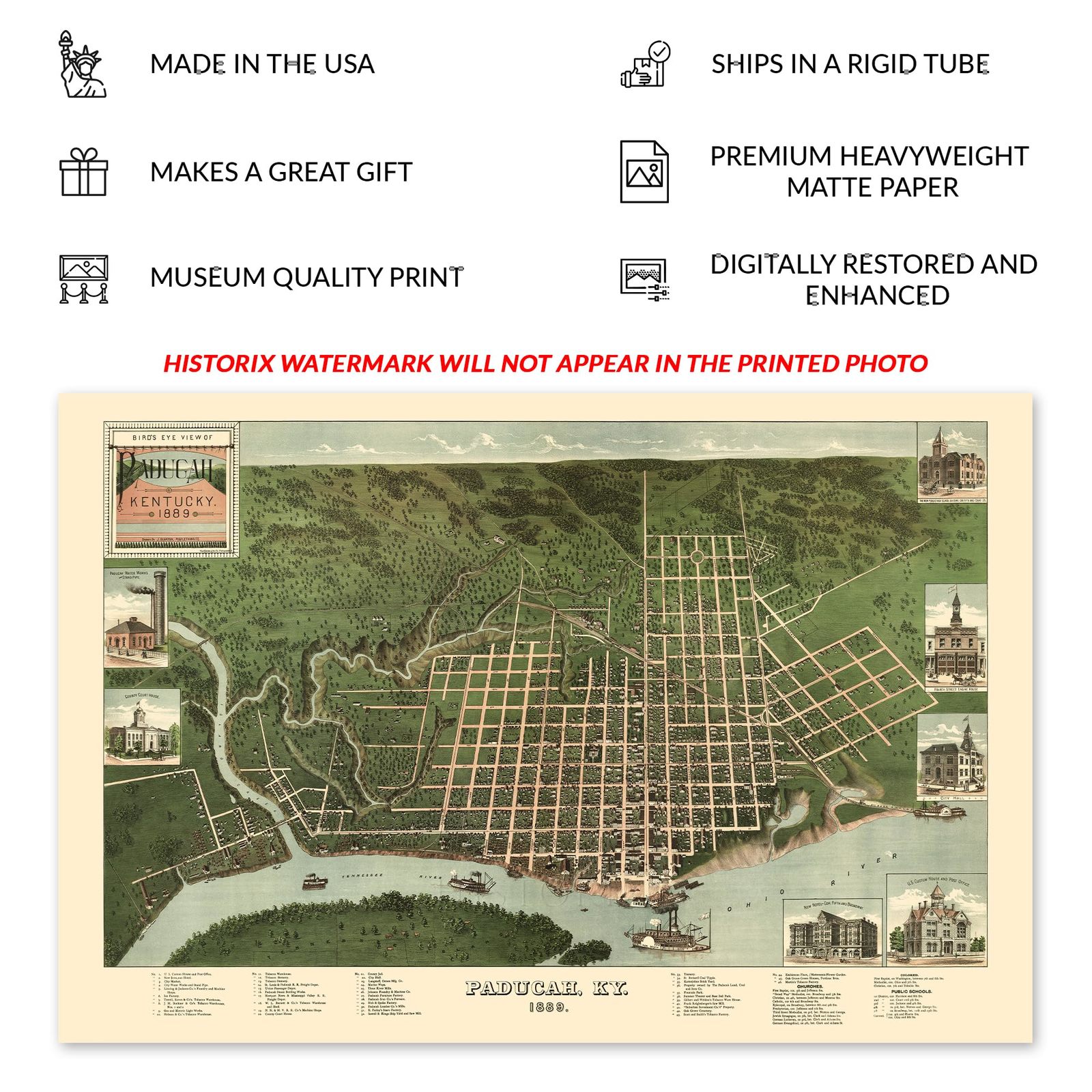
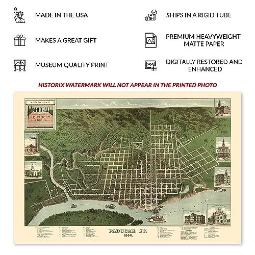
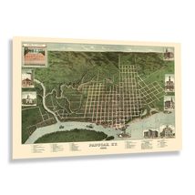
Located at the Tennessee and Ohio Rivers confluence, Paducah lies halfway between Nashville and St. Louis and was expanding rapidly at the time of this publication. The first Americans established communities in 1821, and Paducah was formally established as a town in 1830, giving way to a burgeoning economy spurred by steamboat travel, mills, and factories that harnessed the power of the rivers. The city was experiencing a significant period of growth at the time of this publication, and dry docks for steamboats transporting goods to market across the Midwest were an essential part of the local economy that attracted residents from across the United States eager for jobs in these thriving markets.
Bird's eye perspectives were produced as marketing materials to entice residents and merchants by promoting prominent civic features, notable buildings, and other local attractions. They were widely popular during the latter portions of the nineteenth century and early parts of the twentieth century, and their distinct aesthetic and unique style immediately transport the viewer back in time, creating an indelible bond between the past and present. This map was published by the prolific Krebs Lithographing Company, which produced numerous panoramic maps depicting cities across the Midwest.
This bird's eye perspective is a true piece of American cartographical history that illustrates the growth, transformation, and advances that the United States was undergoing as the nation neared the turn of the century. The industrial revolution was creating significant prosperity during this period, and Paducah was experiencing remarkable growth.
Additional Details
------------------------------
Bullet point: VINTAGE MAP REPRODUCTION: You?ll love this high quality historic reproduction of 1889 Paducah Kentucky Map Poster. Our museum quality prints are archival grade, which means it will look great and last without fading for over 100 years. Our print to order maps are made in the USA and each map is inspected for quality. This beautiful artwork is a perfect addition to your themed decor. Vintage maps look great in the home, study or office. They make a perfect gift as well.
Product description:
Located at the Tennessee and Ohio Rivers confluence, Paducah lies halfway between Nashville and St. Louis and was expanding rapidly at the time of this publication. The first Americans established communities in 1821, and Paducah was formally established as a town in 1830, giving way to a burgeoning economy spurred by steamboat travel, mills, and factories that harnessed the power of the rivers. The city was experiencing a significant period of growth at the time of this publication, and dry docks for steamboats transporting goods to market across the Midwest were an essential part of the local economy that attracted residents from across the United States eager for jobs in these thriving markets.
Bird's eye perspectives were produced as marketing materials to entice residents and merchants by promoting prominent civic features, notable buildings, and other local attractions. They were widely popular during the latter portions of the nineteenth century and early parts of the twentieth century, and their distinct aesthetic and unique style immediately transport the viewer back in time, creating an indelible bond between the past and present. This map was published by the prolific Krebs Lithographing Company, which produced numerous panoramic maps depicting cities across the Midwest.
This bird's eye perspective is a true piece of American cartographical history that illustrates the growth, transformation, and advances that the United States was undergoing as the nation neared the turn of the century. The industrial revolution was creating significant prosperity during this period, and Paducah was experiencing remarkable growth.
Format: wall_map
|
Why are we showing these items?
Booth
Historic Prints |

|


-
Refine your browsing experience
We can show you more items that are exactly like the original item, or we can show you items that are similar in spirit. By default we show you a mix.


This item has been added to your cart
 HISTORIX Vintage 1889 Paducah Kentucky Map Poster - 24x36 Inch Bird's Eye View o added to cart.
8 available in stock
HISTORIX Vintage 1889 Paducah Kentucky Map Poster - 24x36 Inch Bird's Eye View o added to cart.
8 available in stock
View Cart or continue shopping.
 Please wait while we finish adding this item to your cart.
Get an item reminder
We'll email you a link to your item now and follow up with a single reminder (if you'd like one). That's it! No spam, no hassle.
Already have an account?
Log in and add this item to your wish list.