HISTORIX Vintage 1860 York County and 50 similar items


Free Shipping
HISTORIX Vintage 1860 York County Pennsylvania Map - 16x16 Inch Vintage Map of Y
$37.99 - $49.99
View full item details »

Shipping options
Seller handling time is 1 business day Details
FREE via to United States
Return policy
Full refund available for DOAs
Details
Purchase protection
Payment options
PayPal accepted
PayPal Credit accepted
Venmo accepted
PayPal, MasterCard, Visa, Discover, and American Express accepted
Maestro accepted
Amazon Pay accepted
Nuvei accepted
View full item details »
Shipping options
Seller handling time is 1 business day Details
FREE via to United States
Return policy
Full refund available for DOAs
Details
Purchase protection
Payment options
PayPal accepted
PayPal Credit accepted
Venmo accepted
PayPal, MasterCard, Visa, Discover, and American Express accepted
Maestro accepted
Amazon Pay accepted
Nuvei accepted
Item traits
| Category: | |
|---|---|
| Quantity Available: |
16 in stock |
| Condition: |
New |
| ASIN: |
B091PQ8817 |
| Item Name: |
HISTORIX 1860 York County, Pennsylvania |
| manufacturer: |
HISTORIX |
| Item Type Keyword: |
prints |
| Brand: |
HISTORIX |
| Unspsc Code: |
52140000 |
| sizes: |
Listing details
| Seller policies: | |
|---|---|
| Shipping discount: |
Seller pays shipping for this item. |
| Posted for sale: |
May 1 |
| Item number: |
1743610034 |
Item description
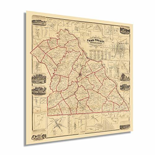
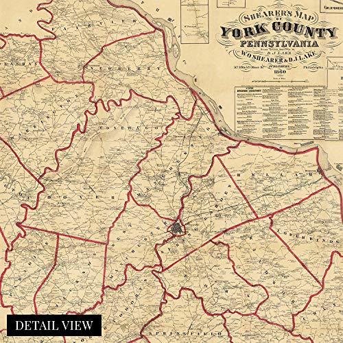
York County was first settled in 1749, and by the middle of the nineteenth century, the eponymous county seat was one of the most populous regions in the United States. This depiction was published one year prior to the outbreak of the Civil War, in which York became the northernmost town to be captured and occupied by Confederate forces. In the years following the conclusion of the conflict York would enjoy a period of economic prosperity as it became an industrial center with steam and railroad manufacturing as well as paper mills attracting residents and merchants alike.
York was the United States' first Capital after the Revolutionary War ended and had been the birthplace of the first Articles of Confederation, the first document uniting the original thirteen colonies, in 1777. This depiction contains an enormous amount of information and incredible detail with the inset illustrations of notable buildings and civic features. Hand-colored lines give this a unique character; the distinctive style and crisp aesthetic immediately transport the viewer back in time, creating an indelible link between the past and present. The surveys used to compile this map were conducted by hand and are remarkably accurate for the period.
York County was in a period of significant growth and transformation in 1860 as immigrants from across Western Europe, Ireland, and Denmark flocked to the region for work in both industrial centers as well as to establish farms in the area's rich soil. This is a genuine piece of American cartographical history.
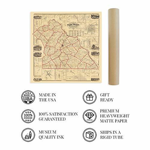
Our museum quality giclee print comes printed with archival ink on premium heavyweight matte paper. Shipped in a sturdy cardboard tube your print will arrive ready to be framed. This eye-catching vintage map reproduction print makes the perfect gift for anyone that loves history and imagery.
|
Why are we showing these items?
Booth
Historic Prints |

|


-
Refine your browsing experience
We can show you more items that are exactly like the original item, or we can show you items that are similar in spirit. By default we show you a mix.


This item has been added to your cart
 HISTORIX Vintage 1860 York County Pennsylvania Map - 16x16 Inch Vintage Map of Y added to cart.
16 available in stock
HISTORIX Vintage 1860 York County Pennsylvania Map - 16x16 Inch Vintage Map of Y added to cart.
16 available in stock
View Cart or continue shopping.
 Please wait while we finish adding this item to your cart.
Get an item reminder
We'll email you a link to your item now and follow up with a single reminder (if you'd like one). That's it! No spam, no hassle.
Already have an account?
Log in and add this item to your wish list.